Any city,
as a 3D block model.
OpenStreetMap building footprints, heights, and real terrain elevation — converted into a navigable 3D model you can explore at human scale. Used for massing studies, urban morphology research, and client walkthroughs.
Try it right now — no download, no signup
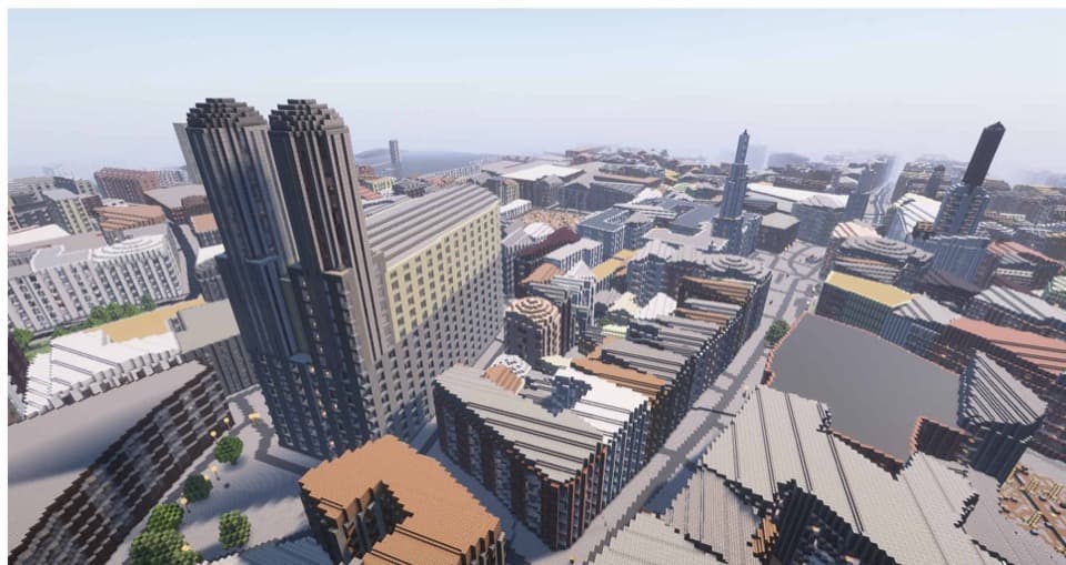
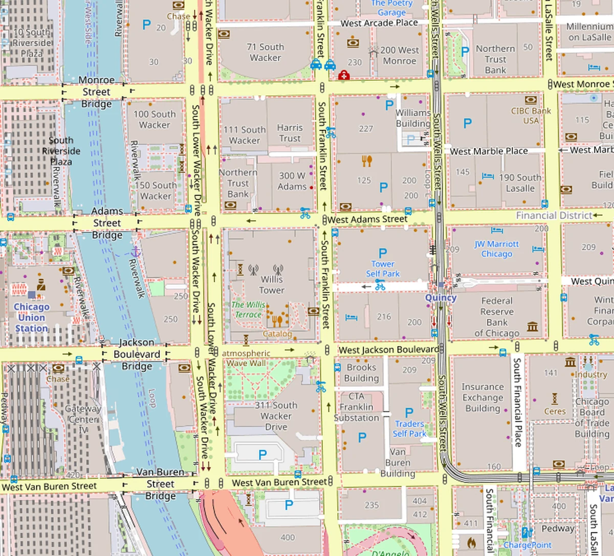
Walk through downtown Chicago — Willis Tower, the Loop, the lakefront — as a real Minecraft world. Drag to rotate, pinch to zoom.
Like what you see? Pick any place on Earth next.
Create your own worldReal cities, block-for-block
Drag the slider to compare downtown Chicago on a real map against the same area generated as a Minecraft world.

What practitioners actually do with it
The common thread: architects reach for it when they need scale understanding fast, and traditional tools are too slow or too expensive for the ask.
Massing & context studies
Drop a proposed building into its real surroundings to understand scale, shadows, and sightlines before committing to a concept.
Urban morphology research
Compare block patterns, density, and street grids across cities — Barcelona's Eixample next to Manhattan next to Paris, all in one coherent medium.
Client presentations
Walk a client through the site in first-person at human scale. Minecraft is oddly effective at communicating what a plan drawing can't.
Studio teaching
Give first-year students a navigable 3D version of a real city to analyze — no GIS license, no CAD learning curve, no render queue.
Model specifications
Technical Q&A
What's the data source and how accurate is it?+
What's the scale — is it 1:1?+
Can I export to another format (OBJ, FBX, glTF)?+
Coverage limits for a large metro?+
Does it handle topography?+
From OSM to walkable model in minutes
$5 hamlet, $10 town, $20 full district. Or go Pro at $25/mo for unlimited metros.
Generate a City/ Also built for